These are America's loveliest rivers
Picture-perfect passages of water
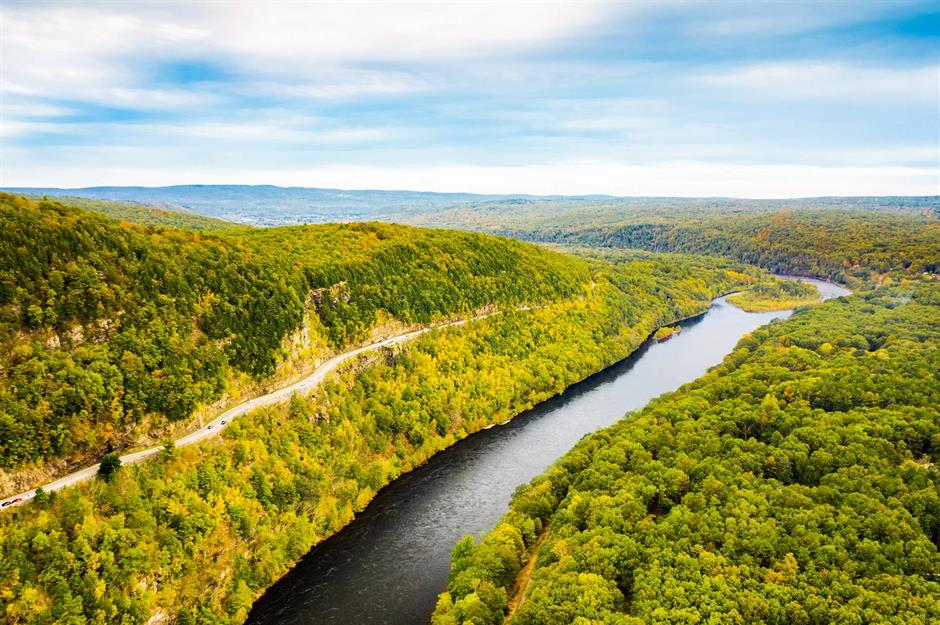
Upper Delaware River
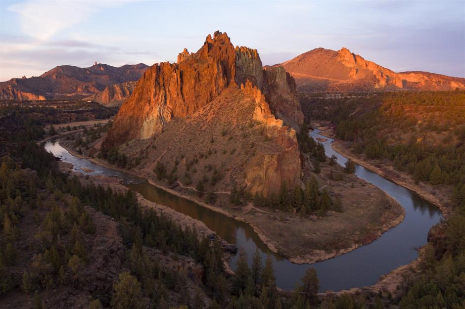
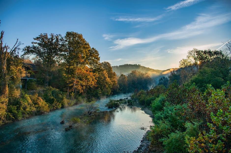
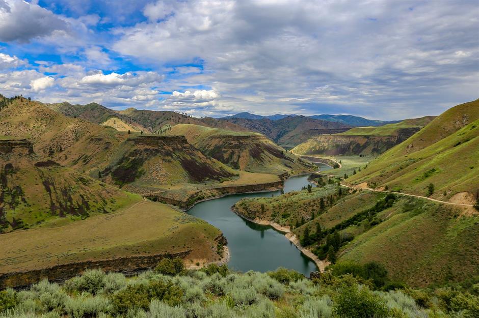
Crooked River
Sponsored Content
Kenai River
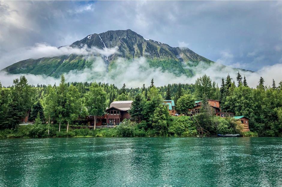
Running downstream from the western edge of the Chugach Mountains to Cook Inlet, near the town of Kenai, this southern Alaskan river packs in one picturesque landscape after another. The upper section is a well-known fishing spot for Pacific salmon and trout, while the six-mile (10km) stretch before it meets Skilak Lake has plenty of fast-moving rapids.
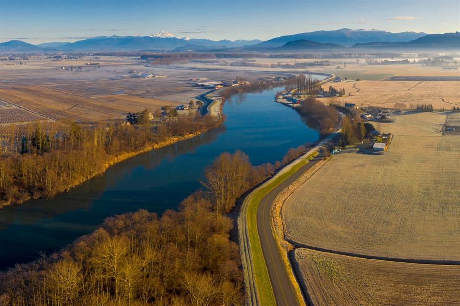
Skagit River
Provo River
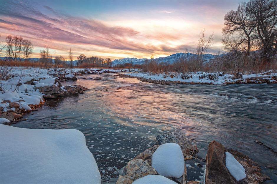
Originating high in the Uinta Mountains, Provo River flows through Jordanelle and Deer Creek Reservoirs before finishing at Utah Lake. Spilling through pastureland and cottonwood groves, its scenic middle course is a magnet for fishermen, containing almost 3,000 fish per mile – the most abundant of which are brown trout.
Sponsored Content
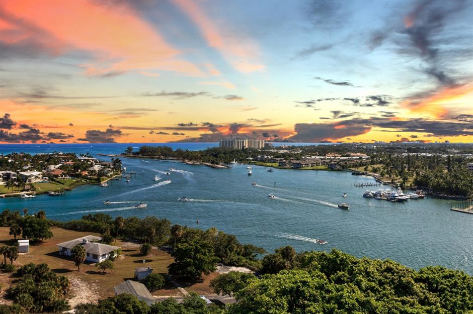
Loxahatchee River
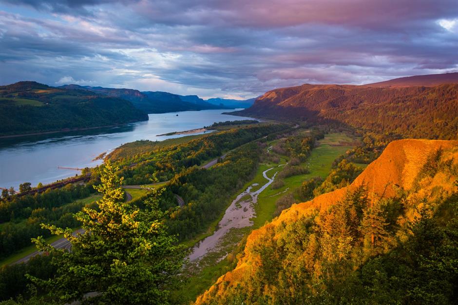
Columbia River
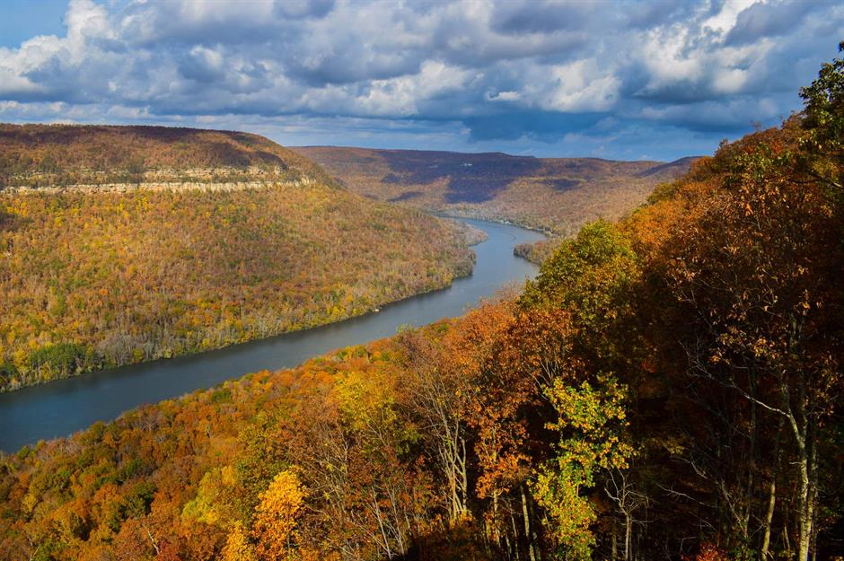
Tennessee River
Sponsored Content
Hanalei River
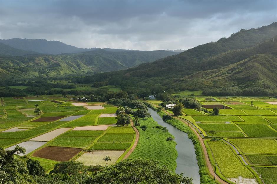
The patchwork of taro fields and verdant peaks on the north of the Hawaiian island of Kauai make a pretty special backdrop for the Hanalei River. Starting at the eastern slopes of Mount Waiʻaleʻale, it flows northwards for 15.7 miles (25.3km) until it reaches the Pacific Ocean. While it may be small, it packs in a diverse array of landscapes, from unspoiled wilderness to pretty pastureland, and turtles can be spotted at Hanalei Bay.
Love this? Follow our Facebook page for more travel inspiration
Rio Grande River
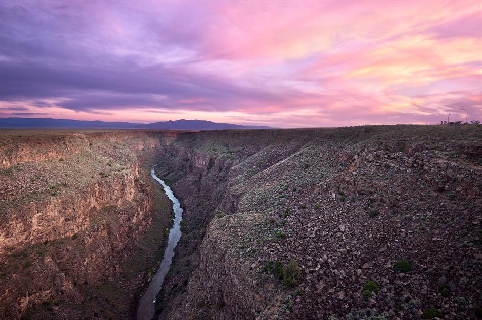
From its source in Colorado’s San Juan Mountains, the Rio Grande River tumbles through Colorado and New Mexico, before forming the US-Mexico border in southern Texas and finishing in the Gulf of Mexico. Around 196 miles (315km) of its upper course are recognized by the Wild and Scenic Rivers Act, prohibiting development on the river or its banks. On its journey, it passes through steep-walled canyons like the one pictured here near Taos, New Mexico, as well as scrubby fields and farmlands.
Bighorn River
Sponsored Content
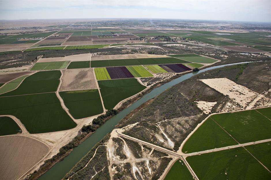
Mississippi River
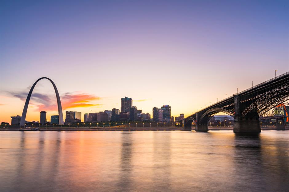
The immense size of the Mississippi River is hard to comprehend. With its tributaries, it drains an area of around 1.2 million square miles (3.2 million sqkm), which encompasses all or part of 32 US states and two Canadian provinces. It has been vital to indigenous people for centuries, who relied on it for food, drinking water and transportation, but early European settlers dispossessed them of their lands, developing farms and cities. The river continues to play a huge part in people’s lives, contributing to the economic development of the upper Midwest and providing recreation opportunities.
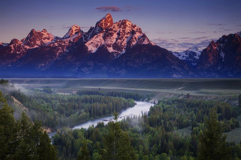
Snake River
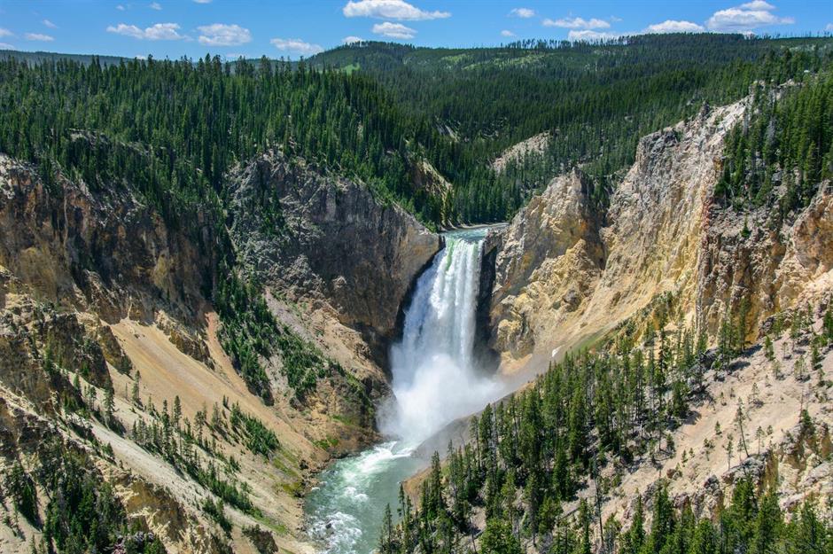
Yellowstone River
Sponsored Content
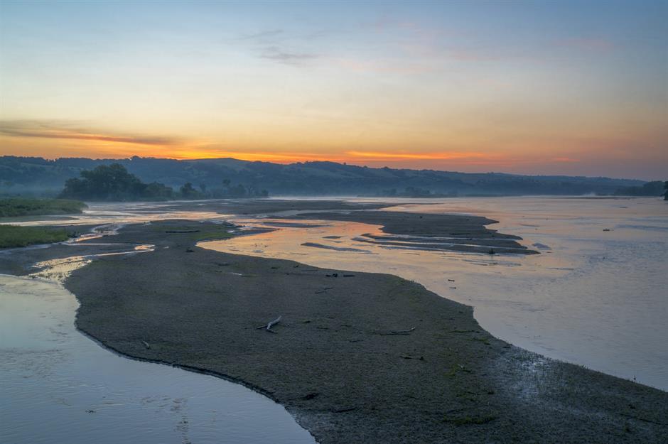
Niobrara River
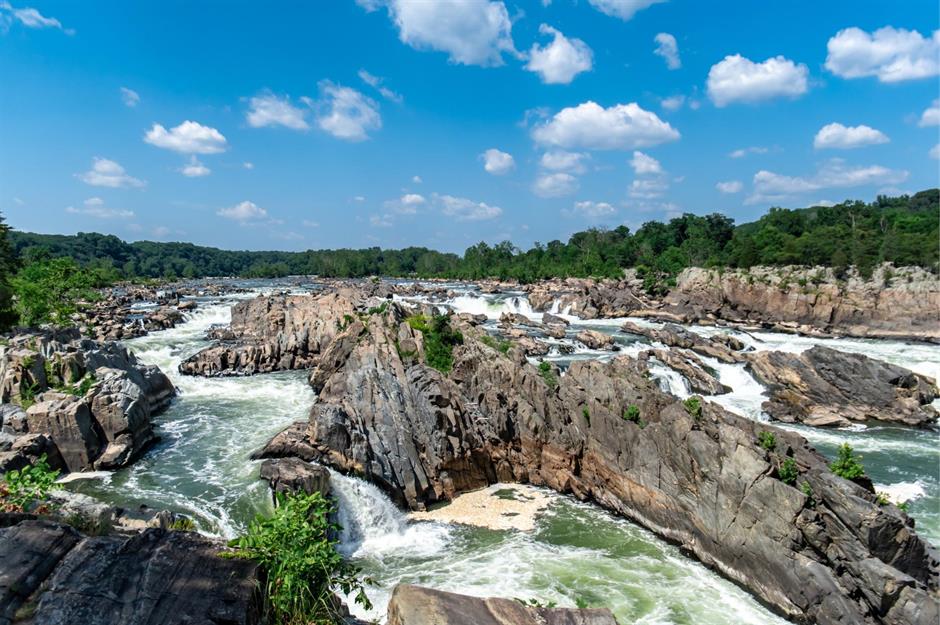
Potomac River
Merced River
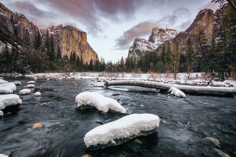
Two-thirds of Merced River’s total 122.5-mile (197km) length is protected by the National Wild and Scenic Rivers System, which has helped it to maintain its untamed feel. Running through Yosemite National Park in California, the Main Fork is a popular spot for white-water rafting, with the 16-mile (25.7km) stretch below El Portal offering thrilling Class III and IV rapids, which are classified as moderately difficult to extremely difficult.
Sponsored Content
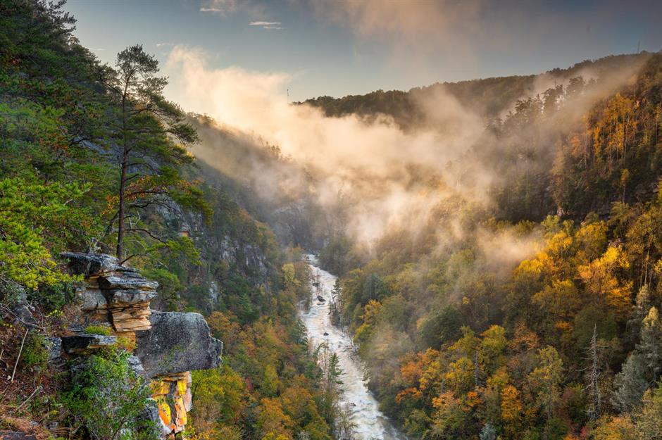
Tallulah River
Buffalo River
Klamath River
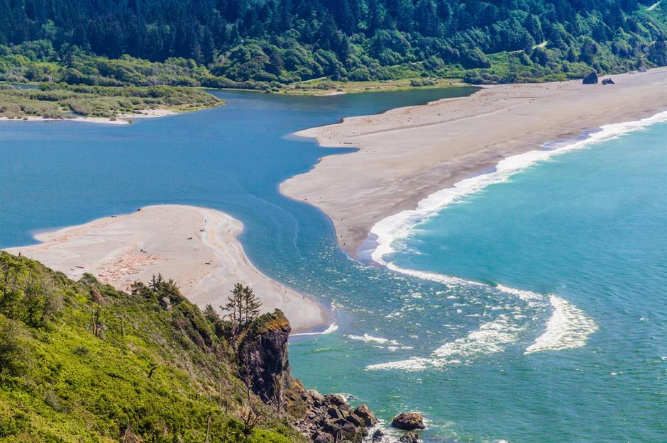
The point at which the Klamath River meets the Pacific Ocean is stunning from the skies, resembling a swirl of milky-hued sandbanks and glimmering azure waters. The river, which flows through Oregon and California, was once the most productive salmon fishing river in western America but in the past century, fish populations have been harmed by dams. Salmon fishing is integral to indigenous tribes including the Yurok and Karuk, who lobbied for the removal of dams here. Thanks to their activism, dam removal could begin as soon as 2023.
Sponsored Content
James River
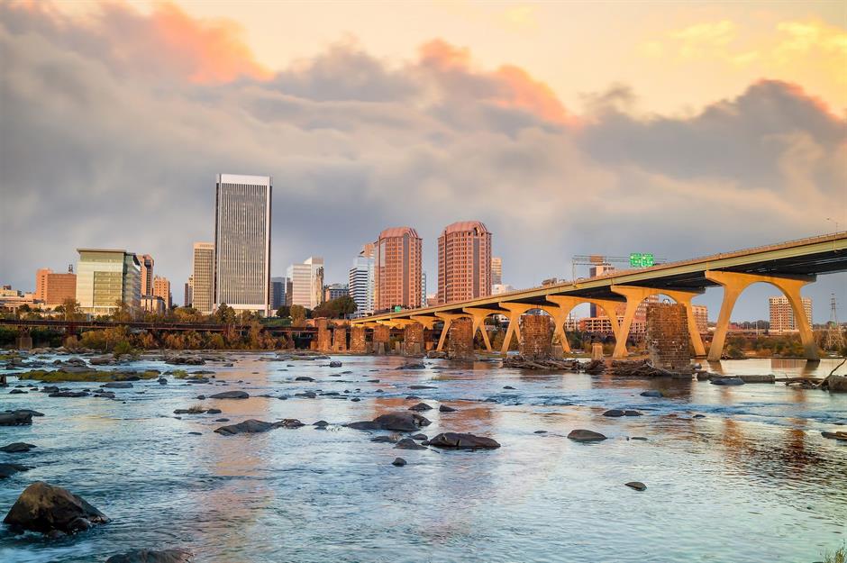
Central Virginia’s James River played an important role in American history. In 1607, Jamestown, in its lower course, became the first permanent English settlement. During the Civil War, it was used by Union soldiers attempting to take control of Richmond. Originating at the confluence of the Jackson and Cowpasture rivers and ending at Chesapeake Bay, the 340-mile (550km) long waterway is Virginia’s largest river and today, around three million people rely on it for drinking water, recreation and commerce.
Salmon River
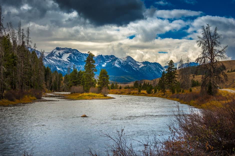
Starting at the foot of the Sawtooth and Salmon River Mountains, the Salmon River travels northeast through a large expanse of national forest before joining the Snake River, of which it is the largest tributary. During the Gold Rush of the 1860s, miners had such difficulty traveling upstream along the river that they nicknamed it the “River of No Return”, a moniker which has stuck ever since. Along its course, there are a few hidden surprises, from geothermal hot springs to white sandy beaches.
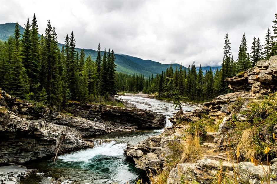
Flathead River
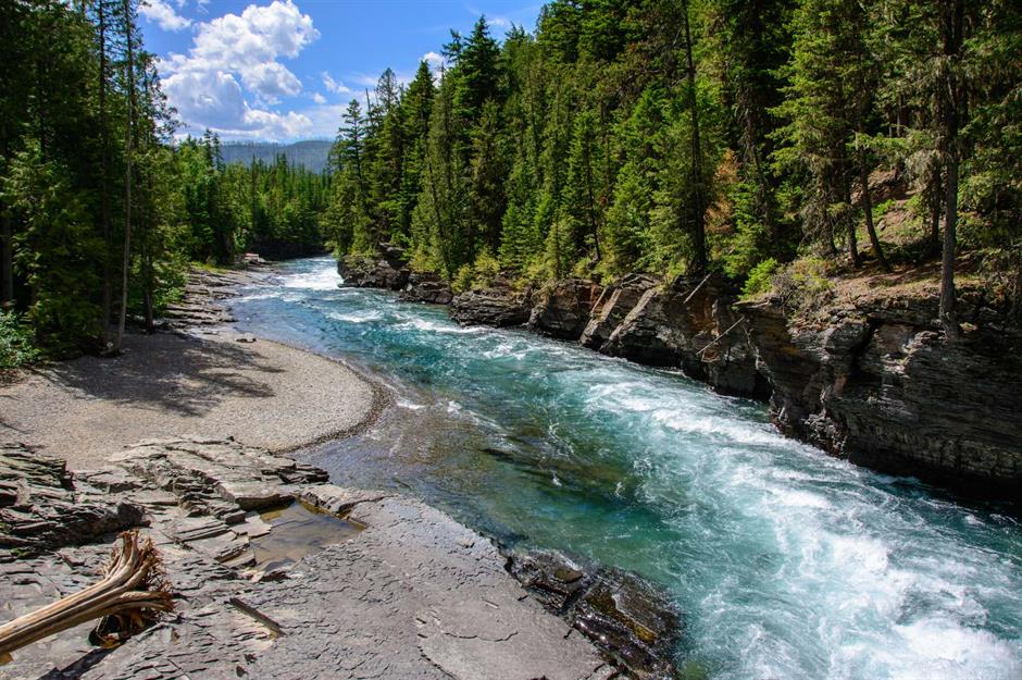
This fast-moving stretch of the Flathead River’s Middle Fork takes in vast, untouched forests alongside its rippling waters. The waterway originates at the MacDonald mountain range in southeastern British Columbia, Canada, traveling for 240 miles (385km) before emptying out into Clark Fork near Paradise, Montana. Its watershed is home to the largest grizzly bear population in the interior of North America, as well as accommodating one-quarter of all stonefly species in the continent.
Sponsored Content
Gila River
Rising in the Elk Mountains in New Mexico, the Gila River travels 630 miles (1,015km) west and southwest to join the Colorado River at Yuma, Arizona. Its surrounding landscape encompasses dense ponderosa pine forests, which are vibrant with wildlife including black bears, eagles, deer, elk and wild turkey. Back in 1924, the river became the first federally-designated Wilderness Area in the US, which laid the groundwork for the later Wilderness Act of 1964.
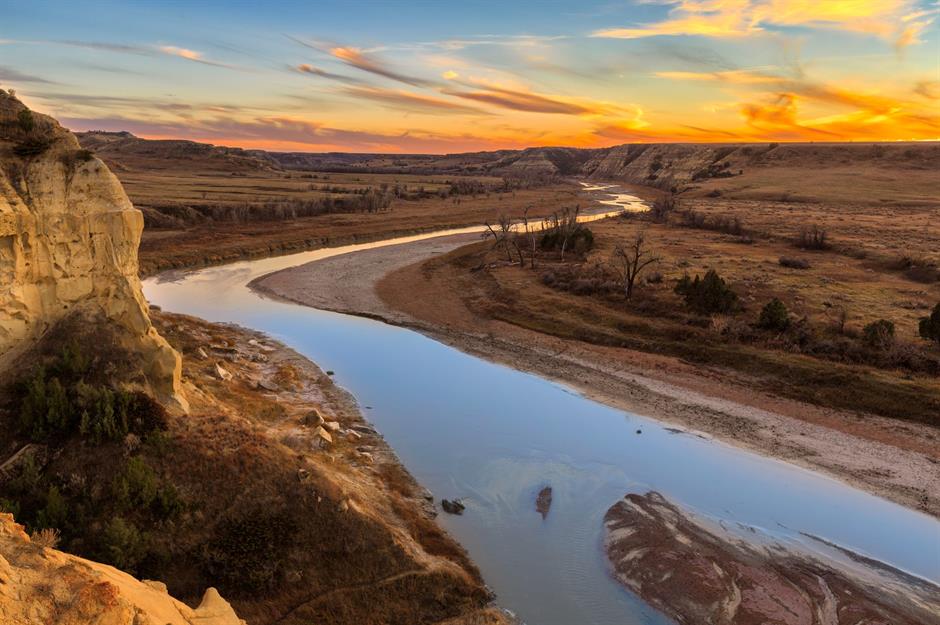
Little Missouri River
Animas River
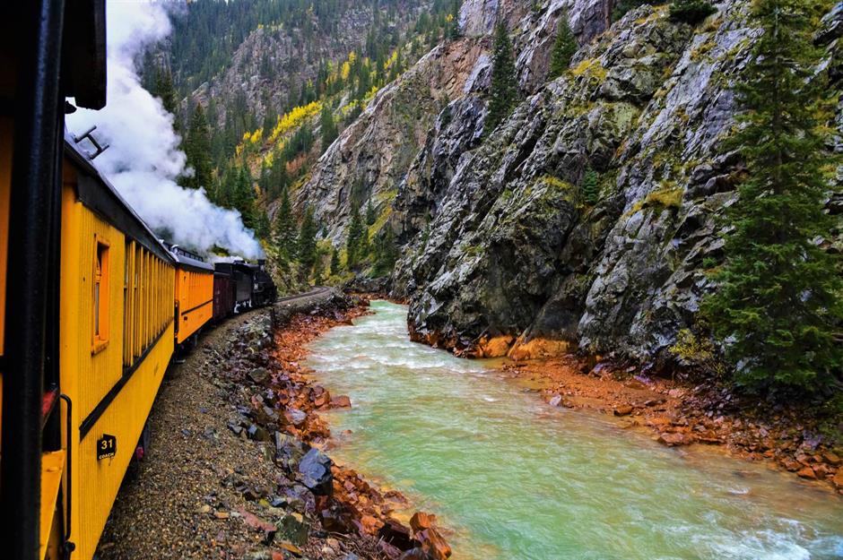
The Animas River originates in the San Juan Mountains in southwestern Colorado, winding its way through deep gorges and panoramic valleys for 126 miles (203km) to join the San Juan River in Farmington, New Mexico. Photographed here from the Durango & Silverton Narrow Gauge Train, which travels alongside it between Durango and Silverton, its craggy, pine-covered slopes have a rugged feel.
Sponsored Content
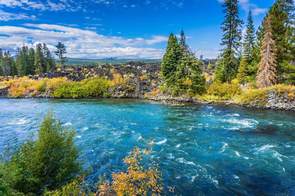
Deschutes River
Boise River
Idaho’s 95-mile (150km) long Boise River has carved out the Treasure Valley like a knife. It starts at the confluence of the Middle Fork and North Fork branches, southeast of Idaho City, and flows through Boise to create the 25-mile (40km) long Boise River Greenbelt, a hugely popular urban park and wildlife habitat.
These are America's most charming and small lakeside towns and cities
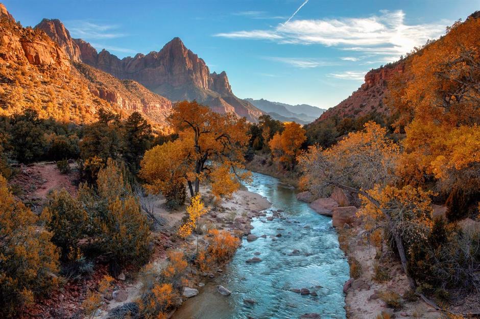
Virgin River

Presided over by the towering Watchman Mountain and seen here draped in autumnal colors, the Virgin River turns pearlescent under the low-lying sun. This incredible waterway, which courses through the states of Utah, Nevada and Arizona, has shaped the dynamic landscape of Zion National Park, Utah. Water flows have helped to deepen canyons and create verdant highlands and lowland deserts, while stormy conditions see waterfalls and boulders erupt from cliffs.
Sponsored Content
Colorado River
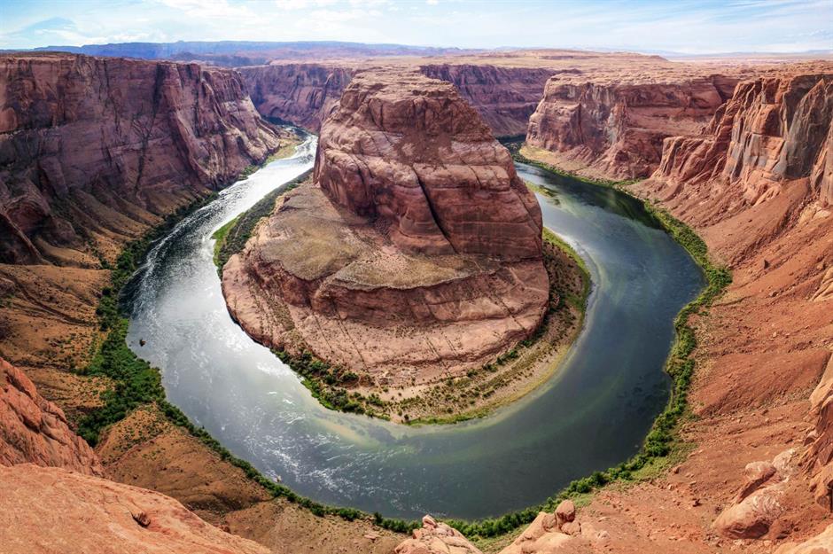
The 1,450-mile (2,330km) long Colorado River travels between Colorado’s Rocky Mountains and the Gulf of California in Mexico, flowing through a whopping seven states in its drainage basin: Wyoming, Colorado, Utah, New Mexico, Nevada, Arizona and California. No wonder it’s often referred to as the Lifeline of the Southwest. One of its most photogenic spots is Horseshoe Bend, a 1,000-feet (305 m) deep, horseshoe-shaped meander in Glen Canyon. This formation was created around five million years ago, when the Colorado Plateau uplifted and the winding river gradually cut through the raised rock.
Comments
Be the first to comment
Do you want to comment on this article? You need to be signed in for this feature